Navigation and Mapping Tools to Find The Best Fishing Locations
TerraFin:
TerraFin is a great resource for optimizing your ocean fishing experiences. Providing access to high-quality satellite imaging and sea temperature charts, which are essential in locating thermoclines where fish are likely to be active. TerraFin users can easily track chlorophyll concentrations and water temperatures, helping to pinpoint fertile fishing zones where target species may be feeding (Chlorophyll is especially helpful when targeting Tuna). The platform's intuitive interface allows for seamless planning of routes to these hotspots, ensuring you spend more time fishing and less time searching. Additionally, TerraFin offers customizable alerts for changes in sea conditions, making it a valuable tool for both planning your trip and making real-time decisions while on the water.
Link - Terrafin
Chart Plotter:
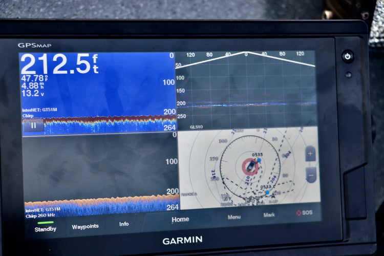
Using a chart plotter can significantly enhance your fishing trips by helping you find the best fishing spots in the ocean and plan your outing with precision. Chart plotters provide detailed marine maps that show underwater features such as reefs, drop-offs, and ledges, which are prime locations for fish. These devices combine GPS technology with nautical charts, allowing you to mark waypoints, track your route, and navigate safely to your chosen fishing areas. By analyzing depth contours and underwater structures, you can identify potential hotspots where fish are likely to gather. A chart plotter also aids in planning efficient routes, saving time and fuel, and ensuring that you maximize your time on the water.
OPENCPN - Free Chart Plotter:
OpenCPN is an indispensable tool for anglers planning their ocean fishing adventures. As a free chart plotter, OpenCPN offers robust navigation capabilities with detailed marine charts and GPS integration, making it easier to locate prime fishing spots across the ocean's vast expanse. Whether you're seeking hidden reefs, seamounts, or traditional fishing grounds, OpenCPN provides the necessary tools to plot a course, mark waypoints, and even overlay real-time navigation data. Its user-friendly interface supports a wide range of plugins and overlays, allowing for customization according to specific fishing needs and conditions. For the budget-conscious angler who demands professional-grade navigation assistance, OpenCPN stands out as a top choice, combining functionality with cost-effectiveness to enhance any fishing trip.
Link - OpenCPN
Tips and tricks from Oregon Lure –
- Fishing on the ocean, or in any waterway, can be much more successful if you keep track of where you catch fish. A key part of our process is to mark each location on our chart whenever we catch a fish or get a significant bite. This practice allows us to navigate back to the same spot later, increasing our chances of success. By tracking these hotspots, we build a detailed map of productive areas. Over time, patterns emerge, such as specific depths or structures where fish tend to congregate. We often find that certain spots are more active during different times of the year.
- Utilizing multiple chart systems can be incredibly helpful, as charts are updated at different times. Double-checking your location and navigation is crucial, especially when on the ocean, where landmarks are scarce and can be extremely deceiving in terms of distance. Relying on various charting sources ensures greater accuracy and safety during your trips.
- TerraFin has become an indispensable tool for us when chasing tuna. Tuna feed near the surface and have specific conditions they prefer. Off the coast of Oregon, tuna can be found anywhere from 15 to 200 miles offshore, depending on the conditions. When searching for a good tuna fishing location, look for water that is 59°F or warmer with a clear blue color like the oceans of the tropics, indicating chlorophyll levels are around 0.25 mg/m³ (ODFW, n.d.).
Weather and Conditions Monitoring
NOAA National Weather Service:
Planning a fishing trip in the ocean requires keeping a close eye on the weather, and using reliable sources for forecasts is crucial for a safe and successful outing. The NOAA National Weather Service (NWS) offers accurate and up-to-date weather information that can be invaluable when deciding to go fishing in the ocean. With detailed forecasts on wind speeds, wave heights, tides, and potential storms, the NOAA NWS helps anglers assess conditions and make informed decisions about when and where to fish. Their easy-to-navigate website and mobile app provide localized marine forecasts and alerts, ensuring you’re always aware of changing weather patterns. By leveraging the NOAA NWS, you can enhance your fishing experience, prioritize safety, and increase your chances of a fruitful day on the water.
Link - NOAA National Weather Service
Marine Weather.gov:
When deciding whether to venture out to the ocean for a fishing trip, utilizing MarineWeather.gov is an excellent way to stay informed about current and forecasted conditions. This comprehensive resource offers detailed marine weather forecasts, including wind speeds, wave heights, and tide information, which are crucial for planning a safe and successful fishing outing. MarineWeather.gov provides easy access to data through interactive maps and region-specific forecasts, helping anglers assess whether the conditions are favorable for fishing. By using this service, you can minimize risks, avoid unexpected weather challenges, and enhance your chances of a productive day on the water, ensuring your trip is both safe and enjoyable.
Link – Marine Weather.gov
Tide Graph:
Understanding tide changes is essential for any successful and safe fishing expedition, especially when it comes to navigating bar crossings. Tides, driven by the gravitational pull of the moon and sun, significantly affect water depths, which can impact both fish behavior and the safety of boat navigation. Anglers can use tide tables and apps to plan their trips during rising or falling tides, which are prime times for fishing as many fish species are more active and feeding near the surface. For safe bar crossings—a challenging aspect of coastal boating—knowledge of tides is crucial. Crossing a bar during slack tide, the short period around the high or low tide when water movement is minimal, is generally safest with an outgoing tide being more difficult. Timing the tides can reduce the risk of encountering strong currents and high waves, making the passage smoother and safer. Always check local tide charts and weather conditions before setting out, and consider local advice and warnings to ensure a safe trip.
Bar Observations:
- Explanation of barometric pressure and its impact on fishing.
- The Bar observations are crucial to any adventure to cross any bar. The US Coast Guard provides the observations to the
https://www.weather.gov/pqr/AllBars

National Buoy Data Center:
Planning a fishing trip can be both exciting and rewarding, especially when safety is prioritized. One essential tool for anglers is the National Buoy Data Center (NBDC), which provides real-time data on ocean and weather conditions. Before heading out, checking the NBDC can offer valuable insights into wave height, water temperature, wind speed, and tide information, helping you select the best times and locations for fishing. This data can be particularly useful for targeting specific fish species (according to ODFW the best surface temps for salmon are between 52-56°F (Schindler, n.d.)). When halibut fishing large rolling waves or strong winds can make it difficult to keep your jig near the bottom. By utilizing the National Data Buoy Center (NDBC), you can improve your chances of a successful catch while ensuring a safe and enjoyable experience on the water.
Link - National Buoy Data Center

Windy.app:
When planning a fishing trip out on the ocean, having access to precise and real-time weather data is essential. Windy.app is a powerful tool that provides detailed weather forecasts, including wind speed, wave height, and tidal information, to help you decide if it's worth heading out to fish. With its user-friendly interface, Windy.app offers an interactive map that allows you to visualize weather patterns and conditions in your desired fishing location. It also features customizable notifications, ensuring you’re always updated on sudden changes in the weather. By using Windy.app, you can make informed decisions about your fishing trips, optimizing both safety and the likelihood of a successful catch.
Link – Windy.app
Tips and tricks from Oregon Lure –
- One of the most challenging aspects of ocean fishing is predicting the weather. As Oregonians know, the weather can change on a dime, and forecasts are often inaccurate. We have found that using multiple sources and taking an "average" of the predictions is the best approach, though it is not foolproof.
- Using Windy.app alongside the National Buoy Data Center can provide a good idea of how rough the ocean will be. When the wind moves in an opposing direction to the rolling waves, it creates washing machine-like conditions, making for a rough afternoon on the water.
Radar with Guard Zone Configuration:
Setting up a guard zone on your radar system is a crucial best practice for enhancing safety and situational awareness while out on the water. A guard zone acts as an automatic monitoring range around your vessel, alerting you to any objects entering this predefined area, which can be especially useful in foggy conditions or at night. To effectively set up a guard zone, determine the typical distance from which you want to be alerted about incoming boats, obstacles, or landmasses, keeping in mind the size and speed of your own vessel as well as the density of traffic typical of the area. It's advisable to configure your radar to display both audio and visual alarms for objects entering the guard zone, ensuring you're promptly alerted. Regular testing and adjustment of the guard zone settings are important to ensure they meet current navigation conditions and needs, providing a reliable layer of safety that helps prevent collisions and allows for timely evasive maneuvers.
Radar Tips from Oregon lure –
- The Higher your radar is mounted the more accurate and the more distance your radar will have. At Oregon lure our vessel has an extra 6 foot mast on the top, as we have had to navigate back in the dark or dense fog where an accurate radar is the only way to see.
Cool But Unnecessary tools –
Starlink – is perfect for anglers who plan to spend extended time on the water. We have tested our Starlink setup up to about 65 miles off the coast of Oregon with great success. It allows for easy communication and the use of many of the tools mentioned above, even when out in the middle of the ocean.
LiveScope – Common among bass fisherman for its forward-facing sonar/top water sonar capabilities. It can really assist the ocean fisher. It gives a more holistic view of your fishing grounds. With the ability to mark fish and have a better understanding of the patterns of the fish.
Omnisecense – Great for late night fishing trips and navigating back to port or the dock in the dark. The Omnisense gives you the ability to see in the dark. If you have ever tried a spotlight in the ocean when there is no light it does almost nothing, where thermal optics allow you to see all your surroundings.
Amcrest Cameras and Meraki Cameras – For the security focused fisher and boater the Amcrest and Meraki Cameras are a great way to keep an eye on your boat when it sits in a marina, or at an offsite location. You can access the cameras remotely, with alert notifications, and recoding’s viewable on just your phone.
Sources:
Schindler, E. (n.d.). 10 tips for targeting ocean coho. Oregon Department of Fish & Wildlife. https://myodfw.com/articles/10-tips-targeting-ocean-coho
Oregon Department of Fish & Wildlife. (n.d.). Albacore tuna. Oregon Department of Fish & Wildlife. https://myodfw.com/fishing/species/albacore-tuna
By:
Sam Blair - B.S. Computer Information Technology and over 20 years of fishing experience
Ray Blair – Distinguished Network Architect and over 50 years of fishing expertise


